The Pace-Number Myth: Why a Route Is Not a Stopwatch
The pace-number myth can make a mapped distance seem like a pace promise. Learn to read route markers and plan an outing that suits your aims.
Does a route’s distance tell you what pace you’ll run? The pace-number myth says, implicitly, that a mapped distance can predict your time; it can’t. A route marker records distance, not the conditions or interruptions that shape a run.
That distinction matters when you are choosing a route for a particular kind of session. Rather than treating the number as a target, use it as one piece of planning information alongside your aim, the route’s layout and the options for changing course.
Distance versus pace
Distance answers how far a route goes. Pace describes how quickly you cover that distance, and it can vary with your effort, fatigue, weather, stops and footing. A line on a map cannot account for all of those on the day.
So the myth is not that distance is useless; it is that distance alone can forecast a running pace. A marked path can help you plan an outing, but it is not a stopwatch or a promise about how the run will feel.
Use distance to decide whether a route fits the time and effort you have in mind. Leave pace flexible, especially if the route is unfamiliar or you expect to stop at crossings.
What markers tell you
Route markers, map labels and saved GPS tracks can help you understand where a path begins, where it turns and how far it is intended to go. They may not reflect a temporary closure, an access detour or the exact point where you start and finish.
Before relying on a marked distance, check the start and end points. A trail map might measure between signposts, while your outing begins at the car park entrance; that difference changes the distance you actually cover without saying anything about pace.
For a familiar route, save a note about where you start and finish. For a new one, check current access notices and keep a shorter way back in mind.
Plan around purpose
Choose the route to suit the session, not to force a pace from the distance. If you want an easy outing, a familiar path with straightforward navigation may help you keep the run relaxed. If you want to practise following directions, a route with clear landmarks may be more useful than a direct line.
Pay attention to what the route asks of you: repeated stops, technical footing or tricky navigation can interrupt a steady effort. That does not make the route worse; it means it may suit a different purpose.
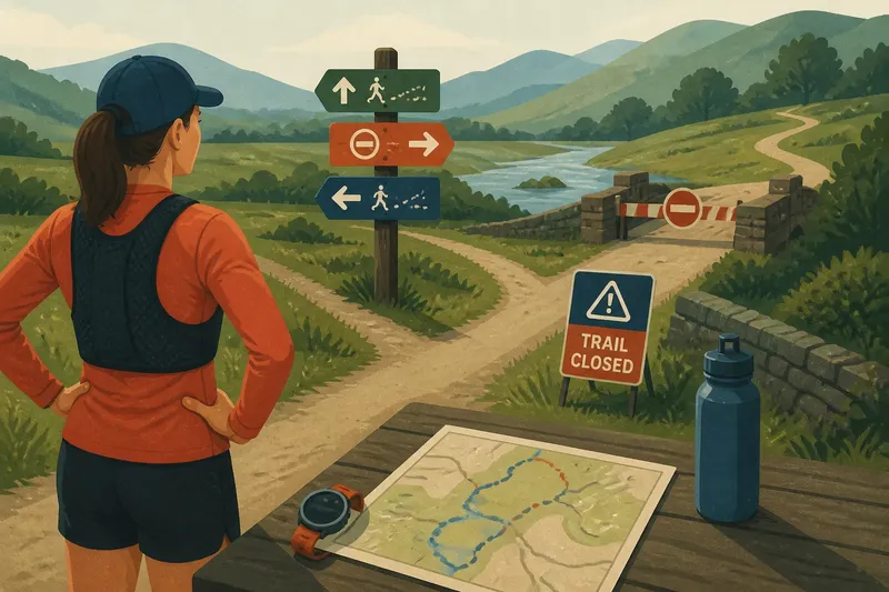
Say you have a saved route labelled as a comfortable distance and plan to run it before work. The map shows a bridge crossing and a branch in the path; you check a local notice and see that the bridge is closed, then identify a signed diversion and a nearby exit. You can use the diversion if it remains clear, or choose a familiar shorter route if the added turns do not fit your available time. The observable result is a plan based on the accessible route rather than an assumed pace.
Keep the plan flexible
A distance can be a useful boundary for planning, but avoid treating it as an obligation. If you feel tired, the route is busy or access has changed, turning back or taking a clear exit is a sensible adjustment.
- Start and finish: Check that the mapped points match where you will begin and stop; if they do, use the listed distance as a planning aid, but if they do not, adjust the route or choose a better-matched map.
- Access notices: Check for closure signs or local updates; if the route is open, continue with your plan, but if it is closed, follow a signed diversion or select another route.
- Route branches: Check whether the map makes junctions clear; if the turns are easy to identify, save the route, but if they are ambiguous, choose a route with clearer landmarks or write down directions.
- Crossings: Check where roads interrupt the path; if safe crossing points are clear, include them in the plan, but if visibility or traffic makes a crossing uncertain, use another crossing or route.
- Exit options: Check for entrances or paths that let you return early; if a clear exit is available, keep it as an option, but if none is apparent, choose a route closer to familiar paths.
- Session aim: Check whether the route’s layout suits the run you want; if it supports that aim, keep it, but if repeated stops or difficult navigation would frustrate it, select a simpler alternative.
Questions about pace?
Can a route distance predict my pace?
No. Distance tells you how far the route is intended to go, while pace depends on your effort and the conditions during the run. Treat the distance as a planning detail, not a forecast.
Why does a familiar route feel different?
Your energy, weather, footing and interruptions can vary from one outing to another. The same mapped distance may therefore ask for a different effort or take a different amount of time.
How should I use a marked distance?
Check where the route starts and ends, then use its distance to decide whether it fits your plan. Keep room to adjust if access changes or the outing feels different than expected.
What if the route is closed?
Follow posted notices rather than trying to get around a barrier. Use a signed diversion if it is clear and appropriate, or choose another route.
Read the route honestly
The pace-number myth becomes easier to avoid when you separate what a route label can tell you from what it cannot. Distance helps with planning; it does not settle how quickly you will run or how the outing will unfold.
For your next run, check the start, finish and current access, then choose a route that fits your purpose. Keep pace flexible and let the map’s number be a useful boundary, not a promise.